Klaus Francke

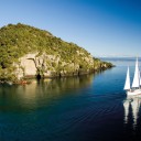
High over New Zealand

“What one can see from above, one can’t see from below.”

Written by       Photographed by Klaus Francke

Thus does German photogra­pher Klaus Francke express the basic truth of aerial photography. Viewed from the air, the world we walk with such familiarity be­comes another place—one in which surprising forms are re­vealed and a remarkable degree of order is apparent. That which we do not perceive close up is, with vertical distance, made plain. Such illumination can be startling.

Francke trained as an archi­tect, but has been a freelance photographer for more than 25 years. He took his first aerial pho­tographs in 1974, over Iceland, but only in the past 10 years has he made this kind of photogra­phy his speciality. During this time he has photographed many countries from the air, in Europe, Africa and Australasia.

In late March and early April of 1997, Francke flew over much of New Zealand with his cam­eras. There being such a variety of landscape within close prox­imity, he found it a relatively easy country to photograph, and from his preparatory research with maps and books he knew which areas he wished to visit.

Nevertheless, having travelled little within New Zealand, he did not fully appreciate what he was going to see once he was aloft, nor what obstacles the elements might place in his way. It was up to his pilot, Alan Smallfield, knowledgeable of the local ter­rain and familiar with the vagar­ies of New Zealand weather from a quarter of a century of flying tourists, geological survey­ors, skydivers and forestry pho­tographers, to act as guide and adviser.

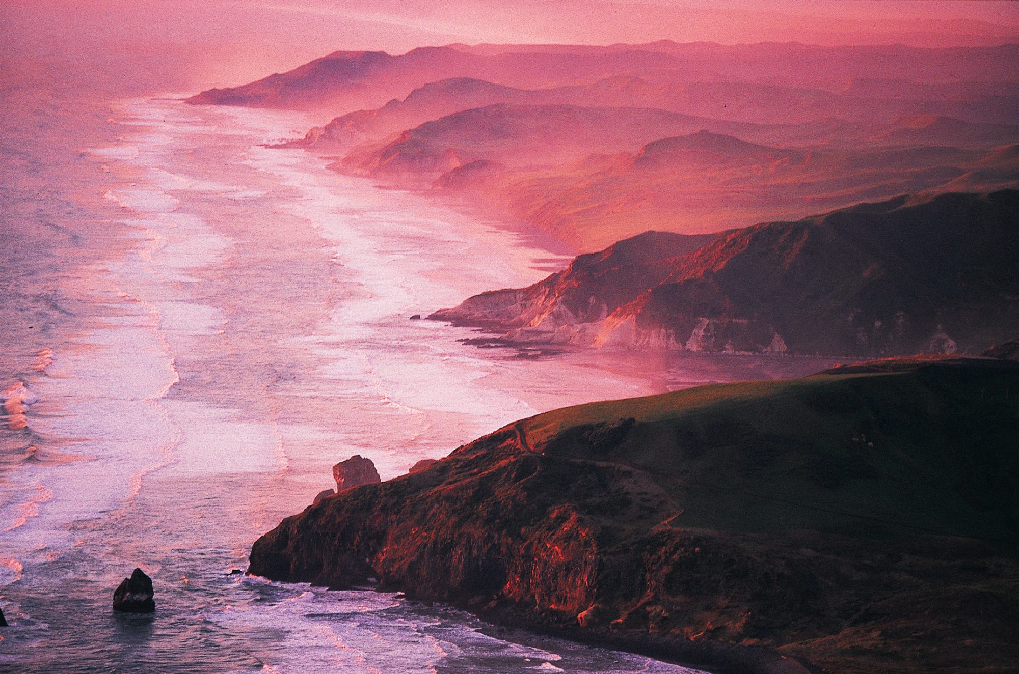
Francke describes the purpose of his aerial endeavours as “to extract pieces of art from the sur­face of the Earth.” Certainly, he cannot be accused of chasing the sort of promotional image that confers on a location an artificial allure. For this photo­grapher, there is beauty beyond the breathtaking panorama. For all New Zealand’s magnificent scenery—its forests, mountains and glaciers—Francke is drawn by the subtleties lurking beneath its surface. He is particularly fond of wa­ter—lagoons, lakes, rivers and estuaries—and was especially impressed by the waterways of the South Island, but an unknown backwater is as likely to attract his lens as a famous lake.

The patterns and textures that reveal themselves only with alti­tude, and the manner, not appar­ent to the ground-dweller, in which light and shade caress the Earth, are what preoccupy him, regardless of location. Thus an ironsand works beside a muddy lake well off the tourist route proves as fertile a subject as the outflow of the mighty Tasman River into Lake Pukaki, with Mt Cook bestriding the horizon.

Through the eye and lens of Klaus Francke, New Zealand Geographic offers this salute to the land.

Clutha River: Manicured pastures south-west of the South Island's longest river, near Tuapeka Mouth, are built upon windblown dust (loess) overlying remnants of the Otago Peneplain-formed when much of the region was eroded by ice down to near sea level about 70 million years ago.
Clutha River: Manicured pastures south-west of the South Island’s longest river, near Tuapeka Mouth, are built upon windblown dust (loess) overlying remnants of the Otago Peneplain-formed when much of the region was eroded by ice down to near sea level about 70 million years ago.
Te Paki: The rich colours of weathered clays on Te Paki Station, near Cape Reinga, betray their volcanic origin. In fact, a scattering of volcanic islands was all that once existed north of Kaitaia, but sand build-up has now connected them to form the Aupouri Peninsula-the tail of Maui's fish.
Te Paki: The rich colours of weathered clays on Te Paki Station, near Cape Reinga, betray their volcanic origin. In fact, a scattering of volcanic islands was all that once existed north of Kaitaia, but sand build-up has now connected them to form the Aupouri Peninsula-the tail of Maui’s fish.
Tasman River: A great glacier once carved the broad valley now occupied by the Tasman River, draining into Lake Pukaki, but most of the rock littering the riverbed today has been carried down from much smaller glaciers that remain in the vicinity of Mt Cook-Aoraki--New Zealand's tallest mountain, visible at centre right.
Tasman River: A great glacier once carved the broad valley now occupied by the Tasman River, draining into Lake Pukaki, but most of the rock littering the riverbed today has been carried down from much smaller glaciers that remain in the vicinity of Mt Cook-Aoraki–New Zealand’s tallest mountain, visible at centre right.
Taharoa: For the past two decades over a million tonnes of ironsand concentrate has been exported annually from deposits at Taharoa, south of Kawhia Harbour on the North Island's west coast. The sand is derived from volcanic ash scattered by Mt Taranaki.
Taharoa: For the past two decades over a million tonnes of ironsand concentrate has been exported annually from deposits at Taharoa, south of Kawhia Harbour on the North Island’s west coast. The sand is derived from volcanic ash scattered by Mt Taranaki.
Bay of Islands: Only 20 000 years ago, during the last ice age, the Bay of Islands was a low-lying river system. Sea levels have since risen, flooding the valleys to form the peninsulas and many islands--such as Motuarohia (Roberton Island), seen here--that have made the area a boater's paradise.
Bay of Islands: Only 20 000 years ago, during the last ice age, the Bay of Islands was a low-lying river system. Sea levels have since risen, flooding the valleys to form the peninsulas and many islands–such as Motuarohia (Roberton Island), seen here–that have made the area a boater’s paradise.
Alexandra: Yesterday's waste, today's treasure. A historic reserve has been created over tailings produced by the Earnscleugh gold-dredging operations on the Clutha River in Central Otago. Dredging began here in the 1890s and reached a peak early this century, when as many as 14 machines worked the alluvial flats.
Alexandra: Yesterday’s waste, today’s treasure. A historic reserve has been created over tailings produced by the Earnscleugh gold-dredging operations on the Clutha River in Central Otago. Dredging began here in the 1890s and reached a peak early this century, when as many as 14 machines worked the alluvial flats.
Rakaia River: Near Mt Hutt, the mighty Rakaia River--for most of its course a braided network of meanders snaking across a gravel bed several kilometres wide--is constrained into a single surging channel. Glacial melt, from the river's source in the heart of the Southern Alps, gives it a milky turquoise colour.
Rakaia River: Near Mt Hutt, the mighty Rakaia River–for most of its course a braided network of meanders snaking across a gravel bed several kilometres wide–is constrained into a single surging channel. Glacial melt, from the river’s source in the heart of the Southern Alps, gives it a milky turquoise colour.
White Island: In defiance of acrid fumes and the constant threat of eruption, a succession of entrepreneurs from the 1880s to the 1920s sought to turn a profit by quarrying White Island's sulphur deposits, but all their ventures ended in failure. Today, the island is valued not for its mineral wealth but its scenic splendour.
White Island: In defiance of acrid fumes and the constant threat of eruption, a succession of entrepreneurs from the 1880s to the 1920s sought to turn a profit by quarrying White Island’s sulphur deposits, but all their ventures ended in failure. Today, the island is valued not for its mineral wealth but its scenic splendour.

More by

More by Klaus Francke