Here’s mud In your eye
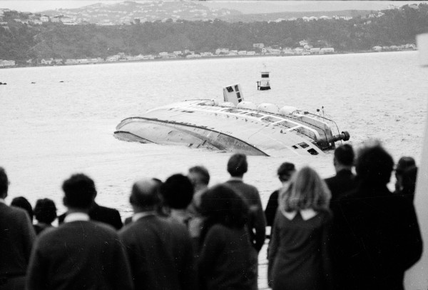
At the end of winter, a house fell into the sea at Te Kopi on the south Wairarapa coast. Although it was not the first house to fall, it had been perched on the edge of a cliff for months, and had attracted considerable media attention. The cliff, at the head of Palliser Bay, had been eroding for years in the high seas caused by southerly storms.
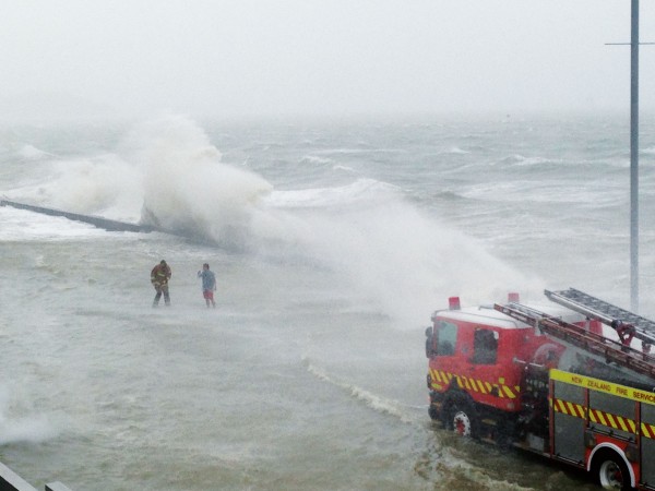
When an onshore wind (such as a southerly in Wairarapa) is very strong, it not only makes large waves, it also causes the sea level to rise and waves to reach higher up the beach. What happens is that the waves are so close together that as one breaking wave runs up the beach, the next wave is on top of it before all the water can run back. Added up over thousands of breaking waves, this can have the effect of raising sea level by up to half a metre. The effects of atmospheric pressure can add a further half-metre to the height of the tide. The cumulative effect is known as a storm surge.
If a storm surge happens during a spring high tide then the sea can reach even higher up on to the land. Furthermore, mean sea level has risen between 10 and 20 cm during the last hundred years as a result of global warming.
Although the erosion caused by pounding waves during a storm surge event can be very dramatic, it is not always the most destructive effect of wind and sea on the land. Even something as simple as the twice-daily wetting and drying cycle experienced by rocks exposed to splashing waves and blowing spray is also a very effective way to erode rocky cliffs. Erosion rates as high as 30 cm a year have been measured in mudstone cliffs at Kaikoura.
Wind not only destroys land, it can also create it. During the ice ages, when conditions were colder and drier, strong winds caused dust storms that moved millions of tons of silt around the world. Known as loess, this windblown silt has been deposited over many parts of New Zealand. In coastal South Canterbury and North Otago, the loess covering the downlands is nearly 10 metres deep in places. The silt has usually been picked up by the wind from a riverbed, after being washed downstream from eroding mountains or the snouts of glaciers.
During the ice ages the sea level was much lower than it is today over 100 metres lower at the last
Manawatu sand dunes sculpted by wind hundreds of years ago now channel the wind like a series of wind tunnels, making conditions hazardous for motorists glacial maximum, 18,000 years ago. At this time the North and South Islands were joined by a land bridge between Nelson and Taranaki, and the Manawatu River joined the Rangitikei, then flowed south to meet the sea somewhere west of Kapiti Island. Its river bed, now under the sea, is the likely source of the loess that covers some of the hilltops around Wellington.
In the colder conditions that prevailed during the ice ages, the tree line was at a much lower altitude, and, consequently, erosion in the mountains was much more vigorous. The Rangitikei and Manawatu Rivers would have carried much more shingle downstream (as the braided rivers of the eastern South Island do today).
The Manawatu also has plentiful loess cover, particularly around Marton, where the wind has shaped the land surface into undulating waves. It also has areas covered in sand dunes, another creation of the wind.
Sand is distinguished from silt by the size of the grains. Particles with diameters between 2 mm and 0.02 mm are referred to as sand, while those with diameters from 0.02 mm to 0.002 mm are known as silt. Sand and silt are generally referred to as primary fragments of parent rock.
Because sand is heavier than silt, it tends not to travel as far from its source region. The sand dunes so characteristic of coastal Manawatu only penetrate as far as 15 km inland. They have mostly formed in the last 3000 years. Loess, on the other hand, stopped being laid down after the end of the last Ice Age, about 12,000 years ago.
Manawatu’s dunes tend to line up with the prevailing north-west winds. Ironically, just as the wind has shaped the dunes, so the dimes now shape the wind. Where the main road cuts perpendicularly across the dunes it creates a series of wind tunnels and sheltered areas. People driving past on high wind days are alternately shoved towards the centre line or sucked towards the road edge in rapid succession as they struggle with the steering wheel.
Even smaller than silt are particles known as clays. They are usually secondary minerals formed through chemical changes to the parent materials. Clay particles in the atmosphere play a vital role in rainfall production, since they act as freezing nuclei to start the growth of the ice particles that eventually melt to form much of the rain that falls in mid-latitudes.
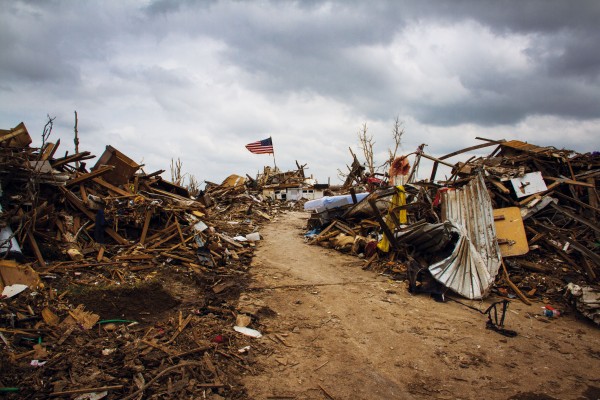
Of course, dust has less beneficial effects, too. Dust storms can reduce driving visibility to near zero. A major dust storm in California’s San Joaquin in November 1991 caused the worst multiple-vehicle collision in the USA up to that time. At least 164 vehicles were involved, with 151 people injured and 17 killed.
The sort of weather most likely to cause a dust storm is an outbreak of strong, gusty winds without rain, especially following a prolonged drought. In the case of the San Joaquin dust storm there had been a drought for six years, so vegetation was sparse and dust was readily lifted off the ground.
The strongest winds in the atmosphere normally occur high up in the sky in narrow ribbons thousands of kilometres long known as jet streams. On the eastern side of a major trough of low pressure the jet stream may be as high as 10,000 m above sea level, but on the western side of the trough it may be as low as 5000 m.
The western side of the trough is also where the low-level air is moving equatorwards with southwest winds in the Southern Hemisphere and north-west winds in the Northern Hemisphere. Consequently, relatively cold air is moving over warmer sea or land surfaces and becoming unstable as it is heated from below. This causes the surface air to rise up into the sky, which in turn brings down some of the higher, fast-moving air to the surface.
Extremely strong winds caused by very deep depressions also move a lot of sand around, even when there is rain at the same time. In Wellington during the Wahine storm in 1968, some cars had the paint sandblasted off their sides in winds exceeding 150 kph.
One of the more famous historical examples of blowing sand occurred in Aberdeenshire on the coast of Scotland in August 1413, when the entire medieval town of Forvie was buried under a 30-metre dune during the course of a single southerly storm. This event occurred close to the extreme low tide in the 19-year tide cycle. Moreover, southerly storms drive water out of the North Sea (in the reverse effect to storm surge), and the extremely low water level that resulted would have exposed an abnormal amount of sand to the wind.
On a global scale, the largest source of sand and dust are deserts like the Sahara. In the last few decades there have been a number of major storms in the Sahara that have led to dust being dropped over millions of square kilometres in Europe, from the Mediterranean to Scandinavia.
Often the dust is brought to earth by rain. In France, researchers measured 150,000 particles of dust in a single red rain drop. This is the equivalent of 10 grams of dust per litre of rainwater.
One of the most unusual consequences of dust storms was the recovery in 1991 of the so-called “Ice Man” from a high pass in the Italian Alps where he died more than 5000 years ago. At that time, the world had just begun to cool after the period of highest temperatures (known as the Holocene maximum) that have occurred since the last Ice Age ended. He died in autumn, sheltering in a rock crevice, and was then covered by winter snowfalls so thick that they did not completely melt the following summer, but formed an ice sheet that lasted over 5000 years.
In the part of the Alps where the Ice Man was found, the winter of 1991 had had below-average snowfalls. A warm March followed, with a Saharan dust fall that turned the snow yellowish. Further autumn snow fell on top of this layer, but melted during the above-average summer temperatures that year. This brought the dust to the surface, which accelerated the melting, because dust absorbs sunlight, whereas snow and ice on their own act as a mirror to sunlight, bouncing it straight back into space.
It is not just dust that is blown about by the wind. Whenever there is a volcanic eruption, the wind is available to blow the ash around. For example, the ash fallout from the great Taupo eruption of around 180 A.D. has been shown to have extended from Taupo to the east, indicating that westerly winds were blowing during the eruption.
Some of the consequences of this ashfall have only just been discovered. Scientists from NIVVA studying the distribution of freshwater fish in streams over the North Island have found that those fish whose entire life cycles are spent in fresh water are absent from most rivers to the east of Taupo. They were killed by ash contamination and have been unable to return.
Like a giant fossilised wind vane stretching from Taupo to Gisborne, the absence of these fish preserves a memory of the wind direction on the day of the eruption so long ago.