
Far North: tail of the fish
A region of scrubby hills disappearing under moving dunes, economically impoverished and barely registering on New Zealand’s psyche, the Far North is favoured by tourists and a special place for Maori. Traditional beliefs have the spirits of the dead travelling up Ninety Mile Beach, Te Oneroa a Tohe, to Te Rerenga Wairua on a spiritual pathway known as Te Ara Wairua. Near the tip of the Cape, they descend the roots of an old pohutukawa and leap off into the underworld to return to their traditional homeland of Hawaiiki.
There are no grand native forests, no mountains, no shops, no nightclubs, no cellphone reception, nothing you could call a restaurant. Most of the homes are modest or scruffy, and the views from the road for much of the journey are commonplace. There are fine beaches, but only down corrugated side roads. And they are not what you might call family-friendly beaches. No cosy little bays with lapping wavelets here. They are vast open sweeps of sand where the surf booms and hisses. Fishermen outnumber swimmers up here.
Yet this is one of the country’s tourist Meccas, a route travelled by hundreds of thousands a year. The northernmost section of this route—the road to Cape Reinga—has just been sealed, the last section of Highway One anywhere in the country to receive that grey icing.
Despite its apparent paucity of attractions and amenities, the Aupouri Peninsula—or Tail of the Fish (Te Hiku-o-te-Ika)—has drawn me for decades. As a teenager, I hitch-hiked up here with a school mate to collect shells. We trudged out to Cape Maria Van Diemen across the dunes, then over scrub-covered hills from Cape Reinga (now known as Te Rerenga Wairua, the departing place of the spirits) to Spirits Bay.

In those days, the mid-1960s, the tar seal stopped about 20 km north of Kaitaia and the road was often buried in sand. There was no gravel at all on the steep track down into Spirits Bay, and it was impossibly slippery for days after rain. A small tribe of lighthouse keepers lived at Cape Reinga. They ran a tiny store which accepted mail and postmarked it “Cape Reinga”. The keepers and their families also sold sub-fossil flax snail shells—there were thousands out towards Cape Maria—hand-painted with crude images of the lighthouse. Even then, the allure of standing at the tip of the country and watching the turbulent seas where the Pacific and Tasman collide made the trip popular, despite the bad road (though some people drove up Ninety Mile Beach, as the tourist coaches do today).
I’ve developed a real affection for all the landscapes up here: the rolling hills of manuka, the startling red clay that bleeds through road cuttings like a wound, the billows of sand that pile up behind the coast. Over the years I’ve toyed with the notion of moving up here, but have always been stumped for a means of living in this remote region. As it turns out, the economy of Northland has always been defined by just two elements: trees and sand.
[Chapter Break]
The earliest inhabitants weren’t concerned with earning a living so much as simply surviving. The land those early voyagers reached was far less benign than the tropical Pacific islands they had left. Geologically, it consisted of vast skeins of sand linking rocky blocks that had once been islands. Tombolos, as these structures are called, are not confined to this region, but there are an unusual number up here. Grandest of all is the whole Aupouri Peninsula, joining the Kaitaia district with Mt Camel, halfway up, and the once rocky islands of Te Rerenga Wairua and North Cape. But sand tombolos also join Cape Maria Van Diemen to Te Paki, the North Cape block to the hills east of Spirits Bay, and Mt Camel and Grenville Point to the Henderson Bay area. While the outcrops of hard rock date back 20 million years or more, the tombolos are probably only a million years old.
The peninsula has not always been so sandy. The dunes hold the bones of many forest birds—including moa, kiwi, kakapo and takahe—together with those of tuatara and kiore. New Zealand sealion bones have also been found at Houhora. The flax snail shells found in the dunes behind Cape Maria, Spirits Bay and Tom Bowling Bay indicate that those areas were once forested, too. And from the sands and peaty swamps that cover the southern half of the peninsula, legions of ancient kauri stumps have been exhumed. Carbon dating gives ages for most of the timber at 30–50,000 years old—as far back as carbon can date—suggesting that the forests that once cloaked the peninsula were gone long before Maori arrived.
Brian Wagener, 88, who was born at Pukenui on the Houhora Harbour and returned to live there in the early 1950s, has come across a lot of swamp kauri while draining land for farming. “Most of the trees lie east to west and have been snapped off at ground level,” he says. “It would take something pretty powerful to do that. Many are metres in diameter, and the wood is still sound, so they didn’t die and decay and then fall. Maybe a cyclone or tsunami toppled them.”
According to Willem de Lange of Waikato University, such a tsunami struck the eastern coast of the northern North Island in 1420, with waves an incredible 45 m high at Henderson Bay. The event likely originated from volcanic activity at the Kermadecs, and larger tsunamis could have swept ashore in earlier times.
When Maori arrived they would likely have found forest on the hills that had once been islands, and kahikatea and teatree scrub in the swampy areas behind the dunes. Many of the older dunes had probably been stabilised by scrub, although by the time Cook sailed past in December 1769 the coast had become “a desart shore”. Indeed, it was the prevalence of sand that led Cook to name the hill at the entrance to Houhora Harbour Mt Camel, and prompted him to write that “no Country upon Earth can look more barren than the land about this bay doth.”
It was a tough place to eke out an existence. Nonetheless, Maori must have lived here in considerable numbers, given the number of pa sites and middens that have been found. Most groups lived on the east coast, but plenty of middens have also been found behind Ninety Mile Beach, on the western side of the peninsula. According to the late Northland historian E. V. Sale, most middens contained only tuatua shells, some held a mix of tuatua and toheroa, but very few were exclusively toheroa. Given the present scarcity of the prized shellfish, one wonders if toheroa populations have always come and gone.
[Chapter Break]
The extensive wetlands Maori would have encountered have mostly been drained for farmland. But one remains. The Kaimaumau swamp lies behind East Beach, south of Houhora, and runs a dozen kilometres towards the entrance of Rangaunu Harbour. Although it is home to a dozen or so rare plants, the vegetation has come to be dominated—like much of the Far North—by wattle, prickly hakea, gorse and manuka.
Twenty-five years ago the south-western edge of this swamp saw an attempt to extract kauri gum, but the Kaurex project was a disaster. Organic solvents were to be used to dissolve gum fragments in swamp peat, and the extracted peat burned to boil off the solvent, leaving the gum behind and the distilled solvent ready for reuse. A fancy refinery was built, but the process didn’t work. Once the solvent was in the peat it couldn’t be removed. The $15 million plant was dismantled, and scrub reclaimed the site.
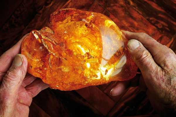
Kaurex was the sad final act in what had otherwise been a long-running and successful production: kauri gum, a byproduct of the Aupouri’s long-buried forests. For almost a century from the 1840s, gum digging was the enterprise of the Far North. Maori had used gum for fuel, and the black ash from its burning as a tattoo pigment. Europeans discovered that it could also be used to make high-quality varnish and linoleum. Something akin to a gold rush ensued, with thousands of men flocking to the Northland gumfields from around the world. The diggers lived in teatree-framed huts clad with gum sacks. They dug by day and scraped gum by night. Nobody struck it rich, but if you worked hard you could make a modest living.
One ethnic group that became well represented on the gumfields of the Far North was Croatians from Dalmatia. They started to arrive in the 1880s when depression drove them from their homeland in the Austro-Hungarian Empire. By 1906, nearly nine per cent of Mangonui County was Croatian. Despised by the British, they were refused credit at stores, forced to pay an alien fee, and excluded from digging on much Crown land that was reserved for those “of British extraction”. But they got on well with Maori, who were also on the lowest rung of the social ladder. Neither group could speak much English, so each learned a bit of the other’s language. Intermarriage followed, and although the majority of Dalmatians returned to Europe, many settled permanently in the north. Kaitaia still sports welcoming signs that read “Haere mai, Dobro dosli, Welcome”—probably the only town in the world to do so.
Between 1845 and 1945, an estimated $50 million worth of gum was recovered from the northern North Island, much of it from the Far North. But it came at a cost. Scrub obstructed the diggers, so they had regular burn-offs, leaving the land pockmarked with deep workings. In his book Way Up North, Harold Thomas describes the whole peninsula covered in a pall of smoke day and night from gumdiggers’ fires.
Destruction of the vegetation opened the way for the invading sand dunes of Ninety Mile Beach, and invade they did. By the 1940s, dunes stretched almost across the peninsula in places. Farmland was buried, and the region was fast reverting to a desert wasteland.
[Chapter Break]
What saved it? Trees. Not the ancient kauri but the modern pine. Starting in June 1959, land behind Ninety Mile Beach began to be transferred from the Department of Lands to the New Zealand Forest Service. And in 1963, forester Des Ogle, equipped with an old Land Rover, a written-off Ford three-ton truck, a loaned marram grass planter, a trailer, a firefighting pump and a few hand tools, was told to start planting a Pinus radiata forest behind Ninety Mile Beach.
In his autobiography, Beyond the Twenty-foot Stump, Ogle wrote, “In the first year we met with all the problems that were to be with us for the next 19 years: tractors in quicksand, trucks loaded with grass down to their trays in quicksand, or stuck miles away from help with broken axles and springs… Working conditions were more than often a dreadful experience: violent southerly gales sweeping inland, gale force winds blowing sand in your eyes, into your ears, and up your nose. Sand was in your bread, in your tea, and your clothes were full of the stuff. At the end of the day we went home like a bunch of wet, exhausted and bedraggled hens.” But his small team accomplished their goal, and by year’s end had planted 400 ha of marram and 30 ha of pines.
The risk of being swallowed by quicksand was taken seriously. One man always walked ahead of the hired bulldozer to test the ground. A horse or two was lost, and some riders and other workers had near misses. In summer, the chief hazard was fire, as the old gumdigger’s fire-lighting mentality lived on. Farmers lit fires to give their cattle access to fodder on scrubby Crown land. Ogle wrote of one regular offender who never lit a fire himself, but contracted Maori who owed him money to do it. The debtor would ride in a rough circle for an hour, lighting a fire every 500 metres, then make his getaway on a fresh horse that had been tied up close to the road. If accosted by a ranger, the culprit would say he was looking for lost stock.
From 1929, elders of northern tribes had begged the government to create work for local people.
One kaumatua from the settlement of Te Hapua wrote to the Minister of Maori Affairs, “Sir, the gum has gone and we have nothing left but sand and fish to eat.”
Their pleas produced no action. But the new trees offered jobs.
Maori land south of Parengarenga Harbour was leased for forestry, and land east of Spirits Bay was later planted. By 1970, foresters had built up a good relationship with Far North Maori, who were closely involved in the process of stabilising the dunes with marram, planting lupins and then pines. Dignitaries and politicians began to take an interest in the forest. The visionary English tree planter Richard St Barbe Baker, who tried to establish forests in the Sahara, visited twice to assure himself that the progress was real. He wasn’t the only overseas visitor to have trouble believing what was being achieved so quickly.
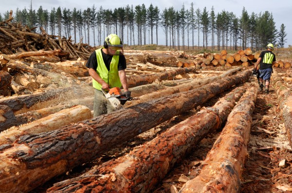
In 1990 the cutting rights to Aupouri Forest were bought by Juken Nissho, now Juken New Zealand Ltd. I visited Juken’s offices at Waiharara, and asked John Robinson, the forest manager, how much Far North land is now covered by Pinus radiata. The answer proved less straightforward than I had expected. Juken NZ’s cutting rights don’t include forests south of Parengarenga Harbour, east of Spirits Bay, or a block of Maori land west of Te Kao. Robinson thinks the total area of forest behind Ninety Mile Beach could be about 26,000 ha, of which Juken has cutting rights to about 20,000.
“We have a Crown Forest License for 25 years, and are harvesting and replanting 600 hectares per year, something under 200,000 cubic metres of wood. We have nine in our harvesting crew here at present, and they’ll produce 600 tonne a day from one-and-a-half hectares.”
Robinson said that because trees grow more slowly on sand, the density of the timber is very good, and harvesting is easy because there are no steep slopes. “Also, sand is easier to drive on when wet, so we can do a lot in the winter, unlike in the forests on steep hills further south that get muddy.”
There is more to Juken NZ’s northern operations than just the forest. The company opened a triboard mill in 1990, and what it calls the Northland Mill in 2001. The latter produces veneer for plywood, which is glued in the Philippines. Virtually all of Aupouri’s timber goes to these two mills, which are the lifeblood of Kaitaia, employing 280 people and injecting some $12.6 million a year into the local economy from wages. Logs from some of the other forests on the peninsula are trucked to Marsden Point for export. There was once talk of barging timber from Rangaunu Harbour to Marsden Point to reduce road traffic, but nothing has come of it.
[Chapter Break]
The Ninety Mile Beach forests provide benefits other than just employment and timber. They have stopped the eastward encroachment of sand and made possible the rehabilitation of land for farming and now horticulture. With less sand on the pasture, one farmer commented, his sheep live two years longer since their teeth don’t wear out as quickly.
The land up here used to have a downtrodden look to it. The paddocks were full of rushes and the animals looked miserable. Now most rushes have been replaced by pasture and there is plenty of fine-looking stock on display, mainly beef cattle. As in many places, however, land remains a sore point with the tangata whenua. So far there has been no treaty settlement, but the ball is rolling, slowly. The claim process began with a letter to the Waitangi Tribunal from the Labour MP Matiu Rata in 1985, detailing grievances pertaining to land and fisheries. The national fisheries Quota Management System (QMS) was being bedded in, and Maori, including Muriwhenua (an umbrella group that included Ngati Kuri, Te Aupouri, Te Rarawa, Ngati Kahu and Ngai Takoto), were not at all happy about the new direction. A Muriwhenua fishing claim was advanced with urgency, and land issues were put on hold.
The fishing claim and the Waitangi Tribunal’s consideration of it (referred to as Wai 22) were broad in scope, covering the whole arena of Maori fishing.
As the tribunal commented: “We knew then why the first major fishing claim had to come from the North; for as [an elder] said, when the tail of the fish moves, the rest of the fish is not lacking for direction.”
The tribunal noted that the Far North had historically been heavily populated, had little land and that rather infertile, so Muriwhenua had had to rely on the bounty of the sea more than most. Accounts provided to the tribunal suggested that local iwi fished all the seas about their extensive coastline, at times going out as far as 25 nautical miles to particular fishing grounds. Fish that could not be used immediately were dried and sometimes traded with other iwi for materials such as greenstone and argillite that could not be sourced in the north.
Despite the guarantee given to Maori in the Treaty of Waitangi that their fisheries would remain in their possession, the tribunal found that since the 1860s successive governments had systematically stripped Maori of their right to fish, often under the guise of preventing overfishing. For instance, in the 1890s northern Maori supplied grey mullet to several canneries, but when overfishing was alleged their gear was outlawed and the fishery was taken over by non-Maori. The tribunal concluded that there had been massive breaches of the treaty, and urged the government to address the issue.

While the Sealord deal and other measures have given Maori a significant stake in fisheries, I couldn’t see much sign that it had helped the people of the Far North. I heard no talk of commercial fishing in Te Hapua, the northernmost town in the country and the traditional home of Ngati Kuri, though there have been some attempts to get aquaculture ventures off the ground. In the 1980s a large box net was established for a time near North Cape, but a trawler servicing the net capsized and several fishermen were drowned. Recently, a shore-based kingfish farm was established at Paua, but it foundered too.
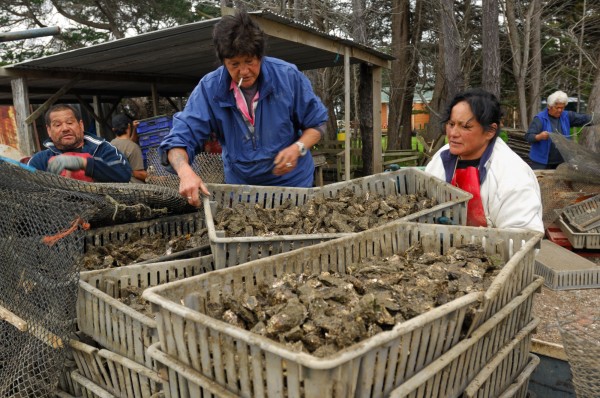
Today there are seven oyster farms in Parengarenga Harbour, covering 40 ha, and they are the main source of employment for the town’s 250 residents. I went out one morning to Ben Waitai’s oyster farm with him and his friend Walter Norman. A flat tractor tyre slowed things down, but eventually we were dragged a fair distance around the foreshore by the tractor in metre-deep water, with Waitai at the wheel and Norman and I sitting in a punt on a trailer. After picking up dozens of sacks of oysters in need of fattening, the three of us left the trailer and tractor and motored across to the farm in the punt. Norman, standing waist-deep in water, stapled sacks of oysters to racks. Before long the incoming tide was up to his chest, and I wondered how long the air-powered stapler would work immersed.
Waitai, who also runs the Anglican Church in Kaitaia, has been involved in oyster farming here since 1987. “When I started, there had already been two failed attempts—by the Maori Affairs Department and Muriwhenua Incorporation. One of them was for a community-owned farm, but it didn’t work out. I started with a training scheme and grew from that. I’m able to employ a few locals, and they work well, but it’s very seasonal work. It’s the main problem everywhere up here—Kaitaia, too. No work. The people are predominantly Maori and young, and there’s nothing for them to do, so they get paid for sitting around. It’s not ideal.”
Over lunch, when we were joined by Norman’s wife, Violet, who works on another oyster farm, talk swung to land and other issues. They don’t like being subject to Muriwhenua, and having to get permission from the incorporation for local land projects. “Muriwhenua is trying to control our lives. The Incorporation Act means we can’t practice our own tikanga in our own communities,” they said.
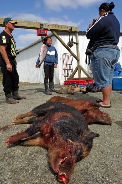
Nor are they especially happy with the Department of Conservation. “They go freely over our land, but we have to get permission, and until recently keys, to go over their land. They stop us taking vehicles out to places like Twilight Beach, and they want to kill all the pigs, horses and cattle that roam across our and their land out towards the North Cape block. Our people use those animals as a larder, and periodically go out there and shoot one or two for food.”
There are no shops or businesses in Te Hapua, and although there is power and telephone, the road is unsealed and pretty rough. A few basic provisions are available at Waitiki Landing, Te Kao and Houhora, but you have to travel more than 100 km to Kaitaia for a supermarket.
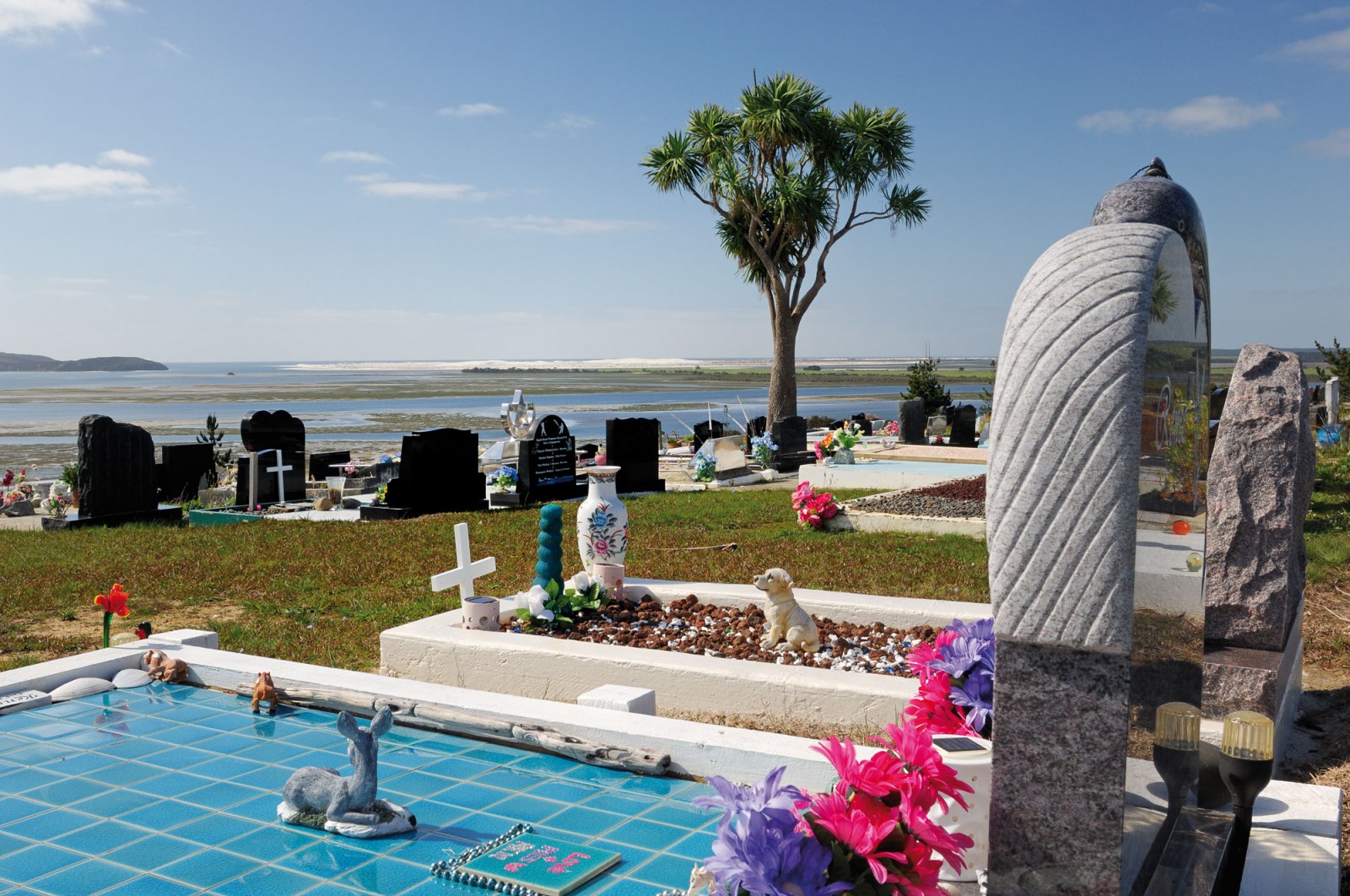
Houses here are unpretentious, and some a bit run down. I hear that building permits are not much bothered with. Cattle and horses graze at will around the streets and unfenced sections of the town. The best view—east to the white sand of Kokota Spit, the southern entrance of Parengarenga Harbour—is from the cemetery up on the hill, and, spookily, it’s the only place for many miles that has cellphone reception.
Talking with Waitai and Norman, I realised that their gripe with DOC was really more with the government. Much Crown land up here has been vested in DOC, and that land is not available for treaty settlements. The Waitangi Tribunal’s report on the Muriwhenua land claim is overwhelming in its exposure of Crown greed, duplicity and maladministration. It’s hard to find the words to sufficiently express the wrongdoing.
The tribunal found that by 1890, Maori had been deprived of more than 140,000 ha, and no hapu had sufficient land remaining to subsist on. And although the report appeared in 1997, little has so far come of it, the reason being that the five iwi making up Muriwhenua have had bitter disagreements about who owns what land. However, iwi are trying to sort out their differences, and the Crown is negotiating settlement terms.
Still, Waitai and Norman are unhappy that the Muriwhenua leaders are trying to get them to accept a settlement that involves, in their area, the return of only 2800 ha of farmland from the former Te Paki station to Ngati Kuri, plus 75 ha around sacred Te Rerenga Wairua. All the rest is DOC land, and not on the table.
[Chapter Break]
While I was scribbling some notes at Waitiki Landing, a boy came over and said, “That man getting gas is involved with the honey.” I introduced myself to Harihona Rata, brother of the former MP Matiu Rata, who told me “everyone calls me Uncle Harry”. He invited me to stay a night with him at Te Hapua and gave me directions. A couple of days later I followed a vehicle track through the scrub, reaching the shore above a low cliff where there were a few old chairs for people to sit while fishing. A road sign reading “Rata” showed I was in the right place, an encampment consisting of a caravan with a couple of rooms attached, and a few dogs and vehicles.
The caravan was occupied by Harry’s daughter and her husband, while Harry—aged 75—lived in the back of his Nissan Terrano. “I’m very happy in here,” he assured me. “There’s plenty of room for me to sleep, and my bed is always with me when I travel.”
That evening I had a cup of tea with the three Ratas in the caravan porch. They all smoked roll-your-owns, while a candle provided the light. They don’t have power, and their drinking water comes off the roof.
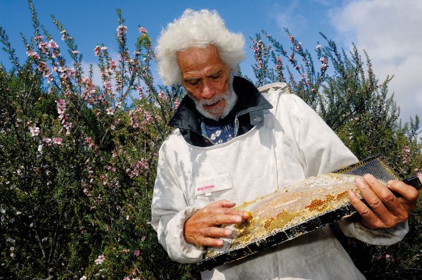
Harry’s enthusiasm for bees and honey was boundless. He’d spent much of his life travelling and working abroad, and only returned to the north in the mid 1990s. “I decided to try bees in 2002,” he told me. He initially set up the business with extended family, but that fell apart. “Once Maori put a finger on something, they think they own it,” he told me with disarming candour. In the end, he formed a partnership with Walter Norman, and the pair now have about 100 hives on Muriwhenua land.
What they’re harvesting could accurately be described as liquid gold. Much of the hill country around Te Paki, Spirits Bay and North Cape running down to Parengarenga Harbour is covered with teatree scrub. Often the trees have pink rather than the usual white flowers, but, more importantly, the nectar is rich in the medicinal factors that have made manuka honey prized as a health supplement. The honey fetches particularly high prices on overseas markets, and beekeepers are willing to pay good money to get it. I’d heard that even South Island apiarists have brought hives up here.
“So far honey has brought $40,000 into the town,” Norman told me. “With the profits, we’ve bought a van for the old people, and they love it.” Later Harry opened some of his hives to show me how well they’re doing.
Ben Waitai, though not involved with honey, has handled Ngati Kuri’s finances, and told me that honey has been more profitable than the iwi’s 30-year involvement with forestry. “The government is trying to get us to replant pines, but I think we are going to let the land go back into teatree. We do better out of it, and we get income every year.”
The country’s northernmost sheep were being shorn at Parengarenga Station as I drove south to Rarawa on the east coast, my favourite beach in the entire country. Here the sand is gloriously white, the water clean and oceanic. North Cape is visible on the horizon. The beach is a pleasant two kilometres long, backed by small dunes and some trees in the north, with a small estuary and interesting rocky areas at both ends.
This autumn day there was a rasping easterly and sand smoked across the beach. In kinder weather I’ve walked far up Great Exhibition Bay from here, and down to the base of Mt Camel.
At Ngataki, on the edge of the forest behind Ninety Mile Beach, I met up with kaumatua Charlie Petera. “The Ngataki people were originally from Te Hapua,” he told me, “but the government offered us this land because of hardship up there. Te Hapua was too remote, the roads were terrible, and the government didn’t have the money to develop that far north.
Apirana Ngata, the Minister for Maori Affairs, suggested we sever the peninsula at Waipapakauri and let it drift off. He got knighted for that!
“We moved here in 1937. The land was leased to us and we developed it for dairying. Relatively recently we bought it from the government.” With a wry laugh he added, “They’d bought it for sixpence an acre from someone who wasn’t authorised to sell it, but we’ve bought it back.”
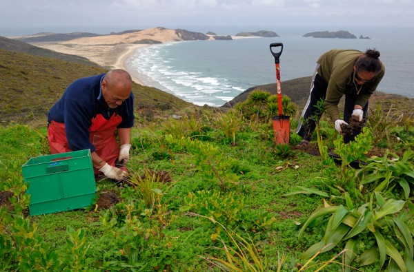
Petera has given a plot of land on the main road for Ngati Kuri Trust Board offices and a native plant nursery. One of his sons, Wayne, runs the nursery and has come up with a scheme whereby visitors to Te Rerenga Wairua can buy a seedling for $20 to be planted at the Cape, and the buyer is given its GPS location so they can keep tabs on its progress. The plants are all grown from seed collected near the Cape. So far, thousands of seedlings have been sold and planted out.
The nursery provides employment for a few people, but jobs remain a preoccupation for Ngati Kuri. “We’re looking at fisheries, tourism, macadamias and avocados, amongst other things,” Petera told me. “I support DOC’s desire to cull exotic animals out towards North Cape. At present they have 11,000 acres where they carry out pest control and we have 10,000 acres next door where we don’t allow poisoning. How smart is that? We should get rid of the pests and bring back kiwi and weka, perhaps cater for tourists. In the northeastern part of Parengarenga Harbour, I’ve seen the rats eating crabs at low tide. It’s terrible.”
Trees, which have shaped so much of Far North history, also appear to be crucial to its future. Commercial horticulture, particularly nuts and avocados that Petera is considering, is relatively new in the Far North. Brian Wagener’s brother, Roy, grew watermelons at Houhora in the early 1980s, and a small amount of citrus is grown now, but the crop that has really taken off is avocados. Again, it’s the sheltering effect of the pine forest behind Ninety Mile Beach that has made it possible. Although the sandy soils up here were once despised by horticulturalists—as were the dry gravels of Marlborough’s Wairau Valley—it’s a different story now.
“Once you’ve broken up the sub-surface pans with a digger—and you may have to go down ten metres—the Houhora Sands are very free-draining, which is great for avocados,” long-time grower Wally Colville explained. “The two other factors that make it good for avocados up here are the consistently warm temperatures and the presence of ample water for irrigation.”
In 1991, the Northland Regional Council compiled all the information available on the Aupouri aquifer, and estimated there might be as much as 600 million cubic metres of fresh water above sea level, and ten times that volume in total, all held in sand and shell beds.
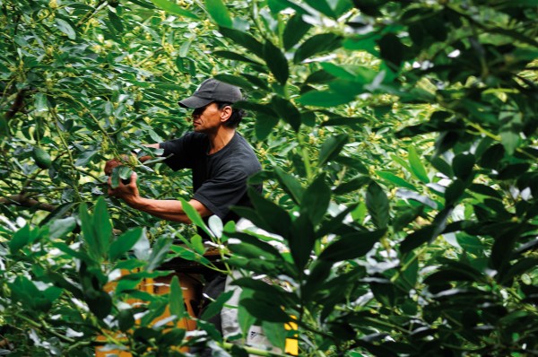
According to Colville, the first avocados were planted on the peninsula in about 1980, when land was selling for $3000 per hectare. Now a hectare of bare land suitable for avocados costs around $50,000. Colville has about 25 ha in bearing trees, and more coming on. “You get quite a bit of fruit at four years, but not until seven do you start to get real pay-back. Our main market is Australia, which we supply from November to February. This season has been especially good, with growers getting $20 a tray for export fruit.” A tray holds 5.5 kg of fruit (16–28 depending on their size) and established trees produce 15–20 tonnes per hectare.
“Up here we enjoy very consistent production. There are no really bad years, unlike in the Bay of Plenty, which is the main producing region.” Colville suspects that production will decline in the Bay of Plenty but keep increasing in the Far North. At present there are between 30 and 40 growers, producing 13 to 20 per cent of the national crop.
The avocado district lies to the west of Houhora, extending both north and south. Houhora, or Pukenui, as the built-up core is frequently called now, is a slowly growing town, predominantly Pakeha, spreading out from the wharf on the western side of the Houhora Harbour. European settlement began here with the flamboyant Subritzky family’s arrival in the 1860s, and Edward Wagener married into the family in 1884. Both names are still prominent in the area. There are about 150 houses in the town now, with facilities such as a bowling club, library, anglers’ club, police station and a small cluster of shops.
“Lots of people came here for holidays, liked it, and thought, ‘We’d like to retire here’, so they did,” says Brian Wagener.
“Then in a few years they made it like the places they’d come from, with street lights, footpaths and so on. I preferred it the way it was.”
Wagener grew up here without much money, but was well fed from the region’s abundant fish and shellfish. He returned after the Second World War. He’s done a lot of gumdigging and farming since—gum from each different area has a distinct smell, he told me—and managed the Wagener Museum at Houhora Heads when it was the region’s main tourist attraction in the 1980s and ’90s. He still enjoys polishing gum.
At Awanui, at the base of the peninsula, I stopped in at the Ancient Kauri Kingdom, a business that buys old swamp kauri from farmers and turns it into products useful and ornamental. The owner, Alan Perkinson, told me they get most of their timber from behind Ninety Mile Beach, and it’s 45,000 years old.
“We’ll run out of it this century,” he said. “We wet-mill it, slab it and dry it very slowly, usually for about two years in low-temperature dehumidifying rooms. The cell structure has deteriorated and it’s no longer a structural timber.”
Large slabs were stacked six metres high, and a variety of grand sculptures and forms awaited completion. There were dining room suites, bowls, huge seats, sculptures for sale, even slabs for your own creation. “Most of the big-ticket items are bought by tourists. Air freight on one 16-seater dining suite was $9000,” said Perkinson. “Counting our Paihia shop and café, we once employed 42 people, but now it’s the lowest ever, only 18.”
As I drove back towards my customary abode—in the belly of the fish—I realised I’d learned something surprising. I hoped to discover how such a remote region survives economically. Although I’ve always thought of the Far North as bare and sandy—parts of it are the nearest thing New Zealand has to a desert—I’ve come to appreciate that trees, past and present, are its lifeblood.
The long-dead kauri are still furnishing a unique and valuable timber, and their gum was the main enterprise for 100 years. Now pine forests provide significant employment and have stabilised the sand, so that farming is viable and horticulture, especially avocado trees, can flourish. Even the ubiquitous teatree is the basis of a lucrative industry. And I suspect that tourists will soon be paying local Maori to show them through native forests in the Spirits Bay area, where some of the country’s rarest plants, such as Bartlett’s rata, can be seen. There are only 34 specimens known in the wild, and unlike other rata which has red flowers, Bartlett’s has feathery white blooms, with fine, white, papery bark. Like the Far North itself, it’s a fragile, lonely and beautiful way of life which survives up here.


