Rivers of wind
As cook’s ship Endeavour approached New Zealand 226 years ago, there were many signs of land over the horizon. The sea changed colour, increasing amounts of seaweed and driftwood were sighted, several seals were passed, floating on their backs, asleep, and numerous birds were seen and shot. Also, three days before Nick Young sighted the headland that Cook subsequently named after him, a sudden wind shift passed over the ship. This type of brief squall, Joseph Banks noted in his diary, was considered a sure sign of nearby land by the ship’s officers.
Nowadays, wind shifts like those Cook encountered can be seen in satellite pictures as rotating circles of cloud forming near East Cape, then drifting hundreds of kilometres downwind. These cloud circles form on the southern boundary of “rivers” of gale-force westerly wind several hundreds of kilometres long and about 30 kilometres wide, which occur when a stable south-west airstream is unable to rise over the North Island mountains and instead pours around the northern end of the Raukumara Range near East Cape.
Stable south-westerlies are the result of an anticyclone approaching over the Tasman Sea, with its associated subsidence inversion (see New Zealand Geographic, Issue 18).
At first glance, the weather map does not suggest the existence of gale-force winds in these situations because the isobars are too far apart. Isobars (lines demarcating zones of constant atmospheric pressure) are usually drawn every 5 hPa. If, instead, they were drawn every 1 hPa then the narrow river of wind streaming away from East Cape would be clearly visible.
The existence of rivers of gales was first demonstrated by ship reports; in particular, reports from the oceanographic research vessel Tangaroa, which has carried an automatic weather station since 1992. The station reports almost every hour when the ship is at sea, and its wind measurements clearly demonstrate the sharp boundaries between these types of gales and the surrounding light winds.
However, the extent of the phenomenon has recently been shown in much more detail by a new instrument carried on the ERS-1 satellite launched by the European Space Agency. This device, called a scatterometer, emits a microwave pulse which is scattered by the small capillary waves on the sea surface. (Capillary waves are the ripples seen on the surface of puddles when a strong wind is blowing.) The amount of the microwave signal scattered back to the satellite depends on the size of the capillary waves, which in turn depends on the wind speed. The satellite is able to measure surface wind speeds in a swathe 500 km wide.
Satellites have revolutionised the practice of meteorology, firstly with standard photographs using visible light reflected by clouds, secondly with infrared photos using radiation emitted by the clouds, and now using sensors such as the scatterometer that actively emits its own radiation—like a flashgun in conventional photography. The ERS-1 satellite also carries an altimeter that measures the height of the satellite above the sea so accurately that it can be used to determine the height of the ocean swell. These measurements show New Zealand casting a shadow on the south-west swell pattern that stretches up to Polynesia. Given the Polynesian navigators’ ability to use wave patterns to detect distant land, it is likely that they suspected Aotearoa’s existence long before they got to it.
Satellite scatterometer results have also shown rivers of strong winds near the various corners of the South Island: west of Fiordland in south-east and north-west Foulwind in a south-west airstream, east of Otago in a north-east airstream and, of course, through Cook Strait in northerly and southerly airstreams.
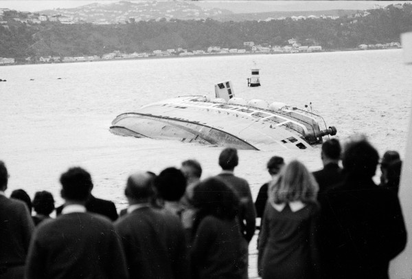
East Cape has a reputation for strong winds that is almost as bad as that of Cook Strait. Yet the strong winds can be used to advantage in yacht races. In 1989, when the Whitbread Race fleet went past East Cape, one yacht gained advantage over the others by riding the river of westerly gales out to the east before turning southwards. Yachts that took the shorter route nearer the coast were left behind.
Nor is this the only stretch of the Whitbread course to experience a local gale caused by the land channelling a stable airstream. When a high is approaching Spain from the west with a ridge extending towards France, a stable north-east airstream blows on to the north-west corner of Spain, creating river of strong wind offshore from the west coasts of Spain and Portugal.
Wind squalls coming off the land not only formed part of the evidence available to Cook that New Zealand lay over the horizon, they also had a role to play in his death. Three days after leaving Kealakekua Bay on the island of Hawaii in February 1779, Cook encountered wind squalls of great ferocity, caused by the high volcanic peaks of Hawaii disrupting the strong easterly trade winds. The foremast of the Resolution was sprung, and his ships were so badly damaged that Cook was compelled to return to the bay for repairs.
Before he left the bay, Cook seems to have been treated by the Hawaiians almost as a god. However, he felt that the chiefs were relieved to see him go, partly because of the strain he imposed on local food resources. Consequently, he returned with some reluctance, believing he had worn out his welcome there.
Indeed, on their return, Cook and his people were treated with far less respect than before. Theft increased dramatically, causing a rapid deterioration in relations with the Hawaiians and culminating in the injudicious confrontation that led to the deaths of Cook, four marines and 17 Hawaiians, including four chiefs.
Nor was the wind finished with Cook’s family. Less than two years later, Cook’s 15year-old son drowned when his ship, Thunderer, went down with all hands off the coast of Jamaica in a hurricane that sank 13 Royal Navy ships. Another 14 years on, 30-year-old James, the only surviving child, was hurrying to take command of HMS Spitfire at Portsmouth when the open boat he was travelling in was caught in strong winds and swamped. His body was found washed up on the Isle of Wight near the wreckage of the boat, with a large head wound and his pockets turned out.
Years before, Cook had listed both sons as crew members on the Endeavour, even though they were only five and six years old and had actually remained in England. He did this in order to advance their careers, in the event of their joining the navy, as with more sailing time to their credit they would be entitled to sit their lieutenant’s exams earlier. Although a serious offence, falsifying a muster-book was given quasi-official recognition through the practice of “widows’ men.” For every hundred crew, two fictitious able seamen were allowed, whose pay was used to create a widows’ pension fund. An example of bureaucracy bending to the winds of pragmatism.